Friday, August 16, 2013

Geumhogang River Island, Daegu

By: Asif Quadri

Terrain: Flat, riverside.

Difficulty: 1- Easy

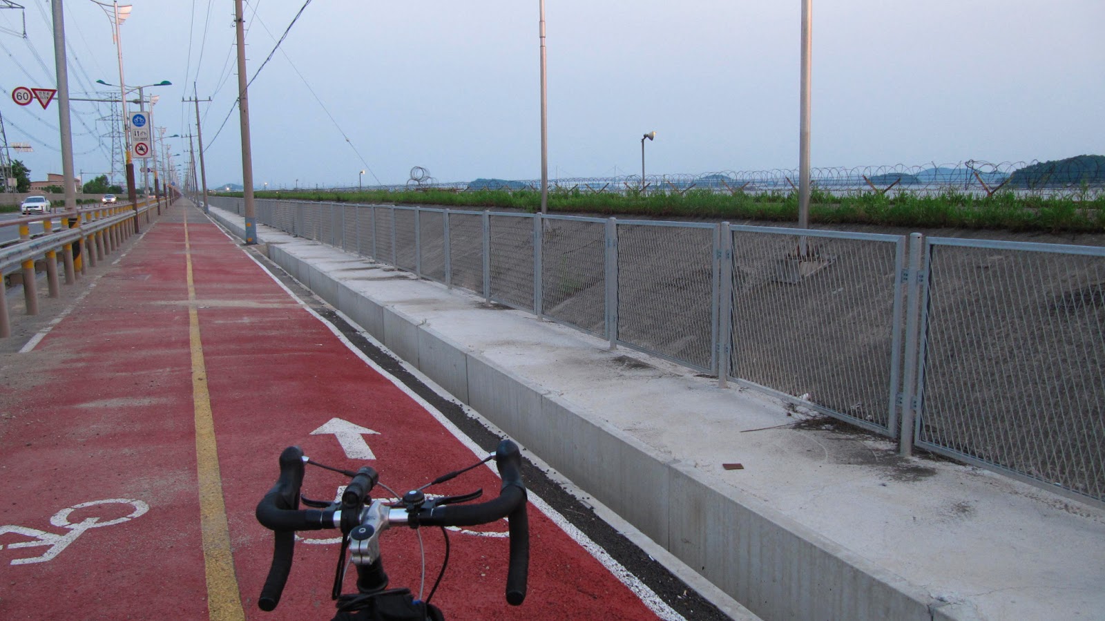
Trail/Path Conditions: The paths are not exclusive for bikes and are mixed in with people walking.

Things to see: Seasonal - flowers in bloom late in the year, horse and cart rides

Getting there: Across from the Paldal bridge linking Daegu to Chilgok just west of Sincheon River downtown along Geumhogang River. There is only one bridge at the eastern end of the island that connects it to the Geumhogang bike trail.

Places to eat: Convenience stores along the river.

My Story:

Thursday, August 15, 2013

Duryu Park Bike Rentals, Daegu

By: Asif Quadri

Terrain: City park with gentle hills.

Difficulty: 1 - Easy

Trail/Path Conditions: Paved paths, but lots of couples and children.

Things to see: Cherry blossoms, trees, a pagoda set in the lake.

Places to eat: Food stands in the park.

Getting there: Duryu Park is accessible by Duryu Station on green line 2 or Seongdangmot on red line 1. Either way you will still need to take a bus/cab or walk 15 mins to the actual park.

My Story:

Originally posted and adapted from: http://blog.travelpod.com/travel-blog-entries/londone7/1/1350169228/tpod.html

Many cities have a large urban park for its city residents to stroll and relax in. London has Hyde Park, Regents Park, and Hampstead Heath, Toronto has High Park, and New York has Central Park. Daegu has Duryu Park which takes up a large chunk of the south west part of the city.

I recently visited Duryu Park for the National Sports Festival as the Aquatic Events were being held there (see earlier entry http://blog.travelpod.com/travel-blog-entries/londone7/1/1350333441/tpod.html)

Duryu Bike Rentals

Close to the aquatics facilities was a bike rental place with over a hundred bikes to choose from. The manager spoke some english and was able to explain the pricing.

A regular bike costs 3000w/hr, a tandem two person bike costs 6000w/hr, while a skateboard style one costs 4000w/hr.

There are many styles in each category to choose from. Sizes range from small children's tricycles to adults sports bikes and tandem bikes.

Rental Rates
Duryu Park is quite large and has many facilities such as a Judo Centre, Aquatics Centre, Tennis Courts, Culture and Arts Centre, Sculpture Garden, Baseball Ground, Tourist Information Centre, a lake, and several temples. Nearby is also the Kolon Outdoor Music Hall and E-World Amusement Park.

The bike rental facility is on the southeast corner. From Duryu Station on the Green Line you would go south, or from Seongdangmot on the Red Line go north-east.

You can plan a fun afternoon with your friends, meeting up, having a leisurely bike ride, and even a picnic while the weather is still nice. Many families also like to come together or grandparents spending time with their grandchildren.

This article was published on the Daegu Blogsite
http://globaldaegu.blogspot.kr/2012/11/duryu-park-bike-rentals.html


Tandem Bikes
  Mountain Bikes

Thursday, June 20, 2013

One day on Ganghwa Island

Date:  June 6, 2013

Terrain:
Mostly flat, with rolling hills

Difficulty:
 
Ara Waterway-Incheon city limits: 1 - flat, well paved, well lit cycle path
Incheon city limits- bridge to Ganghwado: 2.5- mostly flat, no bike path, narrow road with some potholes, poorly kept or no sidewalks. Few street lights at night. 
Ganghwado: 1.5- Mostly flat if you stay near the shorelines. Bike paths for most roads. Heading inland, there are fewer bike paths and more hills, but car traffic was never a problem, even on a holiday.

How to get there: 
With bike: AREX train to Geomam Station. Follow Ara Waterway until the path turns left. Follow the path to the bridge entrance (on left). Cross the bridge and continue north (straight).  Take the bridge to Ganghwado (first bridge on left). 
Without bike: See here

Accommodations:
I stayed in 프리존 (Free-Zone), a love motel in Gimpo before entering the island. On the island there are many places to stay and there are many camping areas as well around the island. 

Things to See: fortresses, temples, museums, tombs, a pre-historic site, tranquil farms and the DMZ

Places to Eat: Everywhere if you like eel. If not, Ganghwa-eup (the city) should have more options. 

My Story:

Crane in a rice paddy, a common sight on Ganghwado

Ganghwado is an island just off the coast of the west coast of Korea. It's also chuck full of things to see, from fortresses, temples, museums, tombs, a pre-historic site, and the DMZ. It's not a small area to cover, and sites are spread out, but we did our best to maximize our time on a one-day bike trip around the island.

The story actually begins at about 7pm the night before. We were debating when and how to get there and though we originally planned to throw our bikes in the car and drive the night before, after examining some maps on the smartphone, we (and by we, I mean Sanghyun) decided that it would be quite feasable to ride our bikes there, as long as we left right at that moment. So, already dusk, we hopped on our bikes, fortunately we're fairly well rigged up with blinking lights on the back and flash lights on the front, and made our way to Seoul Station to hop on the AREX train to Geomam station.

Once at Geomam station, we followed the Ara Waterway to the last bridge which crosses the canal. I was worried about crossing the bridge at night, but I was pleasantly surprised to find everything connected by bike path. We crossed the bridge and followed the path north. Luckily, the bike path was well paved and well lit, because it was now after 9pm.

The well paved bike path continued until the city limits of Incheon. As soon as we crossed into the city of Gimpo, the bike paths dissapeared (also helped by the fact that there is a military base which comes right up to the edge of the road as well. Here was the scary part. Intermitant street lights and no sidewalks or bike paths on a narrow two lane road at 10pm. I have a flashlight on my bike, but I realized quickly that it was way too weak. Fortunately Sanghyun's was extra strong and shone brightly enough for me to see most of the potholes before I hit them. Again, fortunately, there aren't many cars on the road at this time at night, but I was very worried about people speeding or drunk driving at that time of night on a lonley country road. Thankfully we made it to the other end and we stopped at the first motel we found along the road, which was probably only 3km but felt like 20km from the end of the bike path.

We asked at the 7/11 out front whether it would be better to stop here at the motel or continue a little more to the island, but the clerk reminded us that motels on the island were significanlty more expencive than on the mainland. So, not really wanting to be on the road anymore, plus not wanting to spend any more money than necessary, we stopped at the first love motel called 프리존 ('Free-Zone', I thought it was 'Prison') and got our room for 35,000 for the night. We could have splurged and gotten a room for 45,000 at the 'hotel' down the road, but personally I don't see much difference.

Crossing the bridge to Ganghwado 

We got a late start due to getting in so late the night before, but we woke up and headed out. It wasn't too far to the bridge to get to Ganghwado, though sidewalks were rough and the streets were full of traffic, sometimes hard to pass. Once we got to the bridge we were traffic-free thanks to this handy bike/walking path along the bridge.

View as you arrive on Ganghwado

As soon as we got to the Ganghwado side, we found ourselves on this fantastic bike path. Separated from cars by a curb and well paved and well marked.

The biggest fortress we found

If you turn right after entering you'll quickly stumble upon the first of many fortresses. I recommend shelling out the big bucks ( I forget, but I think it was less than 2,000 won) for a pass to five fortresses. You probably won't want to visit all 5, but if you visit two or three, it will still save you money in the end. As you continue north you will continue to pass fortress after fortress, so you might be glad for buying that 5 fortress pass.

Typical road on Ganghwado

After visiting three fortresses, we decided to make our way to the DMZ at the northernmost tip of the island. To get there, you need to follow the signs for the 강화평화전망대 (Ganghwa Peace Observatory). Be aware that most of the signs pointing here are not in English, so it's easy to miss if you're not paying attention!

Just checking the map... 

Heading up to the DMZ and observatory there were bike paths for at least 50% of the ride, but even when there weren't bike paths, we never felt in danger. Dispite being a holiday and all the traffic we saw before getting onto the island, up here there were very few cars at all (as you can see on the road behind us in the photos).

This is about as close as we were able to get to the DMZ

Unfortunately, upon reaching the DMZ, we were not allowed to enter because we were on bike. Apparently, according to the guard, bikes and motorcycles are not allowed into the DMZ. The soldier suggested that we take the bus, but when we asked when it passed by, he said 'not often', so we gave up and instead decided to find the famous pre-historic dolmen.

Pre-historic Dolmen

A dolmen is apparently a pre-historic style tomb, and this one on Ganghwa is the most famous in Korea. Probably because it's pretty huge. There were no bike paths getting here either, but we took back roads and there were very few cars, and most of them were driving slowly as they were probably lost tourists.

Bike path back to Incheon

Finally, it was time to say good-bye to Ganghwa, though there is still so much left unseen. That just means, though, that we have a good excuse to come back again! So long for now Ganghwado!

Waiting for the train home at Geomam Station

Wednesday, June 19, 2013

Geumhogang, Daegu

By: Asif Quadri

Date:  September, 2012

Terrain: 1- Mostly flat river trail.

Difficulty: Easy used by children and families.

Trail/Path Conditions: Well maintained bike paths with sign posts and occasional maps.

Things to see: Biking groups and enthusiasts, a very easy quiet escape in the heart of the city into tranquil settings.

Places to eat: A couple of food stands otherwise you have to exit and go a block or two back into the city to look for a mart.

Getting there : The Geumhogang river runs east to west along the northern side of Daegu. The Sincheon dissects it in half north to south. Very easy to access either of the trails from any part of Daegu.

My Story:
Originally posted and adopted from: http://blog.travelpod.com/travel-blog-entries/londone7/1/1347207943/tpod.html#_


Back home in Toronto I used to do lots of biking along the Lakeshore trail which ran for about 30kms. It also branched northwards along the Don and Humber Rivers providing an extensive river biking network. I've missed having these biking trails and was envious of other korean cities such as Seoul which has a long biking trail along the Han River.

Daegu does have a downtown biking trail along the Sincheon River but I lived nowhere close enough to be able to access it. The new neighbourhood I've moved to brings me closer to the Geumhogang River. This river crosses the entire city of Daegu along the north and seperates it from the northern suburb of Chilgok. It also connects to the downtown Sincheon River.

Starting at the Paldal Bridge

One of the joys of moving to this new neighbourhood is I now have easy access to the river biking trail which runs to many parts of the city. I live close to the Paldal Bridge crossing so have the choice of going east to downtown, or west further out into the suburbs. Normally I would go in one direction but for the purpose of this entry I did a big loop going both ways.

The path is mostly paved except for a small area west of the Paldal Bridge. However, the paving seems to be going up quite fast since my last visit and should be complete in the next couple of weeks.


Under construction

Considering this is a major Korean city the path is quite tranquil and removed from the urban setting. You would think you were out in the wilderness somewhere. However there's no need to panic as other bikers will regularly pass you by, so no feeling of isolation here.

Westbound Trail 


An interesting section is a baseball field west of the Jungang Expressway crossing where the KTX line also crosses the river. As you wait KTX and Muganghwa trains will pass at regular intervals in both directions although it takes lots of waiting to photograph

KTX passes by a baseball field


The path will continue west thru Seojae-ri towards Dasa and the end of the Green Subway Line. However, I turned around to head back downtown

Looking at Seojae-ri

Again it's very peaceful and isolated like being in the countryside, far removed from being in the city. I passed back by the KTX crossing where trains were passing at regular intervals. There are also many types of river crossings with various types of architecture

Riverside Highway

River Span Crossing

Passing back under the Paldal Bridge and new Line 3 crossing I headed towards downtown where the trail had more bikers.

Heading Eastbound to Sincheon

I passed by the Daegu Solar city and you can see the Exco further in the distance.

Daegu Solar CityTower

Shortly after you will come to the Sincheon River crossing. Here you have the choice of going south through downtown, or crossing the river and continuing to head east. I headed east as the downtown path is more crowded with bikers, joggers, pets, people strollling, and children.  

Downtown Sincheon River Path

East of the Sincheon you come to an older part of the trail painted like a track and a popular fishing spot. There is also a rare sign marker indicating 4kms back to the Paldal Bridge.


Signpost Marker

Just east of the Sincheon is a strange vegetable field. It starts with many carved head totems similar to the ones in Andong.

Entrance to strange vegetable field


I now returned back as my tires were having problems so I need to get them changed as I bought this bike used. It was another 4kms back to the Paldal Bridge as the sign indicated and the sun was now beginning to set.


I've heard the trail runs from Andong to Busan (maybe 200kms)  though I'm not adventurous enough to actually test if thats true. However I will continue to explore east and westbound on weekends and while the weather is good

This article was published on the Daegu Blogsite
http://globaldaegu.blogspot.kr/2012/09/biking-geumhogang-river.html

A map of the river trail has recently started to go up in some spots
Map of the Geumhogang River Path

Seonyudo

By: Asif Quadri

Date: September, 2012

Terrain: Mostly flat with some modest hills

Difficulty: 2-Moderate - mostly easy except hill climbing

Trail/Path Conditions: This is a rural island so it's a mix of car roads and walkways through vegetable fields

Things to see: Natural scenery, coastline, small hamlets, rural life, lighthouse.

Getting there : You must take a ferry from Gunsan on the mainland. Bike rentals were arranged by the pension through our tour group. You can try asking at  the port terminal for more information.

Places to eat: By the ferry port restaurants and mart.

Organized by: The Korea Blog/ KOCIS

My Story:

Originally posted and adapted from: http://blog.travelpod.com/travel-blog-entries/londone7/1/1348493001/tpod.html


Sunday morning on Seonyudo, we went biking early, the sun was quite strong considering it was only 9am and how strong the winds had been the night before.

Low Tide

As you leave the guesthouse area there is a large and long hill on a turn to take you to the main part of the island.

Then we continued along the shoreline but turned inland to a small village. Here there was some artwork painted on the wall to decorate the village. Everyone took turns posing but the giant wings which seem common in Korea.

Village Artwork

Behind the village was a small harbour with a lighthouse. It had a giant red hand held up motioning you to stop. As we reached the lighthouse the inscription said it was actually two palms pressed together in prayer. If you make a wish here your prayers will be answered.

Praying Hands Lighthouse


After this it was time to bike back to the guesthouse taking another shortcut. By now we had worked up and appetite for a late breakfast and morning biking in the sun.

Biking Back Inland
Biking back inland

There was a fish and vegetable soup, along with small grilled fish and other side dishes. I mixed the soup with my rice and added the grilled fish on top to make a filling breakfast.

Hungry for Late Breakfast

The owner and his wife saw us off and had been great hosts. They are actually a retired couple from Gyeonggi-do province outside Seoul and have only owned the business for about a year.

Mt. Palgong - Songnimsa Temple

By: Asif Quadri


Date: July, 2012

Terrain: All uphill the further into Mt Palgong but relatively easy downhill on return.

Difficulty: 2.5 - difficult going / easy return

Trail/Path Conditions: Heading north from Chilgok, Daegu you are mixed in with heavy traffic on an industrial highway. Once you turn into Mt Palgong the traffic gets lighter and there are bike paths.

Things to see: An abundance of temples, natural scenery

Places to eat: Restaurants close to motel district

Getting there : Mt Palgong runs the entire northern length of the city of Daegu. It can be accessed from either Chilgok/Dongmyeong at the western end (buses 427, 527, 730, rapid 3). The eastern end has more famous temples Gatbawi and Donghwasa (buses 401, 101, rapid 1)

My Story
Originally posted and adapted from: http://blog.travelpod.com/travel-blog-entries/londone7/1/1342987463/tpod.html

As I'm moving out of my neighbourhood in a couple of weeks I decided to bike north into Gyeonguk Province and Dongmyeong which I haven't visited the entire time I've lived here. I heard there was a nice temple along the Mount Palgong trail I wanted to check out.

 Biking to Mount Palgong

I live on the northern end of Chilgok and biking north a few minutes I reached the city limits and the sign markers for the start of Gyeongbuk province.  

Entering Gyeongsangbuk-do
Heading north for another few kilometers the road becomes a country highway. Its not the best place to go biking as the traffic was quite fast and there were many entranceways to industrial yards. However, the main turning to the temple was only about a kilometer away so I was able to avoid the traffic from there on

Signpost to Temple 
Signpost to the temple

Scenic mountain road

The turn off road had a signpost describing it as one of koreas most beautiful routes. The Mount Palgong trail runs east-west across the city for about 30 kms and it does have many scenic spots. I had wanted to come to see the cherry blossoms but came too early before they were in bloom.

Start of Mountain Road 
Start of mountain road
 
Temple in the distance

Heading to the temple there is a large reservoir and a ship restaurant along the roadside. You then come off the main road to a side road and follow it a short way to the temple.

Scenic Resevoir
The temple was quite near to the turning off the main road. I keep hearing from friends that they don't want to see "just another temple" but this proved to be yet another interesting find, different from all the other Mount Palgong Temples.

The complex had a large brick stupa in the centre lawn, buildings on either side of the rectangular lawn, and some outer buildings. The main building was undergoing some exterior restoration work.


Inside the main large building there were three large seated gold buddhas. At one end of the hall one wall was a large unpainted wood carving with many faces and lots of detailed etchings

Large Wood Carving

There was another colourful building facing the centre lawn which had some surprises. This building housed life-size painted wood figures. I've seen them before about 2ft high but this was the first time seeing them life-size. There was also bell tower painted in great detail. It had a large bell, drum, and a hanging dragon which is hollowed out and used for tapping from the inside.


 Bell Tower
I then discovered another building which I named the 1000 Buddha hall. Behind the three large gold Buddhas were rows of identical smaller Buddhas set on an incline ascending up to the roof. It was quite an impressive sight and how the temples in Taiwan and Vietnam were to give a distorted perspective of infinity.

1000 Buddha Chamber

Heading back was much faster as I sped down the incline I had to bike up to get here. The ship restaurant takes you back to the main road and reservoir

 Country lane back
I've driven past this reservoir a few times when we came in this area for school dinners so this was the first time to see it slowly up close.

House on the lake

Back on the main highway heading south I passed by an interesting country house and roadside tombs. I then made it back inside Daegu City Limits and headed home.

This article was printed on the Daegu Blogsite
http://globaldaegu.blogspot.kr/2012/09/biking-mt-palgong-songnimsa-temple.html